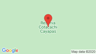
Yanahurco, Cotacachi - Cayapas Reserve


Location: In the provinces of Esmeraldas (Cantons: San Lorenzo, Eloy Alfaro y Río Verde ) and Imbabura (CCantons: : Cotacachi, Urcuquí and Ibarra).
Yanahurco de Piñán at 4,535 meters above sea level. Located inside the Cotacachi-Cayapas Ecological Reserve.
Yanahuarco mes in kichwa “Black Hill"
The Yanahurco hill is surrounded by other elevations such as the Pulumbura, Pilavo, Parulo, Nagñaro, as well as the Chachimbiro volcanic complex (Huanguillaro, Tumbatú, Hugá).
The estimated time to ascend to the Yanahurco Volcano is approximately 5 hours, this slope crosses the sand and volcanic ash, if the weather is favorable you can photograph the landscape that gives us of the Ecuadorian Andean Cordillera.
In the mountains of Piñán you can practice different adventure activities such as: trekking, mountain biking, camping.
Piñan How to get there?
The three route options to get to Piñán:
- San Blas-Iruguincho-Hacienda El Hospital- Pantaví- Piñán: is a short drive (20 km using a 4 × 4 on the type of muddy terrain (October to May) or sandy (July to September). This presents the ideal route for the adventure.
- Chachimbiro, northwest direction: Chachimbiro - Tumbabiro - Pablo Arenas - Cahuasquí - San Luis - Buenos Aires - La Primavera - Chinchiví - Pantaví - Piñán: travel for 90 km it is a better route (the use of a 4 × 4 is optional).
- From Ibarra, on the north, via Panamericana to San Lorenzo- Salinas - Guadal - San Jerónimo and then up the mountain to Corazon de Guadual - San Francisco- San Luis - La Merced de Buenos Aires - La Primavera-Chinchiví- Pantaví - Piñán : travel for 60 km of a first order route through several habitats until reaching the cold and windy moorland.
Yanahurco Hill
- Difficulty: Routerism
- Permitted Activities: Hiking, climbing, landscaping, photographing, environmental interpretation, wildlife observation, camping, horseback riding.
- Specialized guide is needed (high mountain).
- Hours: 05:00 to 11:00.
- Justification in favor: Scenic beauty.
- Against: Difficulty, climatic factors (rain, fog), lack of infrastructure
Moors of the Yanahurco
- Difficulty: Routerism
- Permitted Activities: Hiking, landscaping, photographing, environmental interpretation, observation of flora and fauna, camping, horseback riding.
- Naturalist guide is needed.
- Hours: 05:00 to 15:00
- Justification in favor: Greater contact with nature and landscape enjoyment.
- Against: Difficulty, climatic factors (rain, fog).
Condor sighting site
- Difficulty: Routerism
- Permitted Activities: Hiking, landscaping, photographing, environmental interpretation, observation of flora and fauna, camping, horseback riding.
- Naturalist guide is needed.
- Hours: 05:00 to 17:00
- Justification in favor: Greater contact with nature and landscape enjoyment.
- Against: Difficulty, climatic factors (rain, fog)

Publicado en:
Publicado por:


