Ozogoche Lagoons


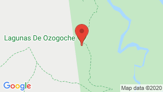
The Ozogoche lagoons are a 45 lagoons or lakes collection within the Sangay National Park, 20 km south from Guamote and 36 km east from Palmira town.
Magic destination that offers peace, tranquility, pure air, silence and a first-hand contact with nature. Also, at night, travelers can experience a beautiful feeling, as if they were closer to the stars.
The lagoons are deep, cold and have a striking dark blue color and in their surroundings there is a large area for camping, hiking, bird watching and mountain biking.
You can visit mountain elevations such as Soroche, Sasquín and others that form the Achipungo mountainous system.
One of the most popular and well-known aspects of the Ozogoche Lagoons is bird watching, especially since in the middle of September there is an event that usually perplexes and baffles those who reach the area.
It is about the migration of ‘chorlitos’ (cuvivi in quichua), a species of bird that attract a lot of attention for their unique beauty. They reach the lakes to end their lives, in a natural holocaust known as the Tribute. Hundreds of these animals are launched systematically and without warning to the lakes icy waters.
It has not yet been possible to explain why it occurs. However, there are those who believe that it is because the cuvivíes are fatigued and affected by the heat, so when they see the water they plummet in search of something that takes away their thirst, but the low temperature kills them instantly.
This place offers the opportunity to go hiking, sport fishing, sharing experiences with indigenous communities, photography and adventure.
Ozogoche, lagoons
Information for the tourist who wishes to visit the Ozogoche Lagoons:
Ozogoche Lagoon location. It is located southeast of the Chimborazo province, in the Cordillera Real foothills, in the Achupallas Parish of the Alausí canton, approximately 90 km from Riobamba.
Laguna de Ozogoche Climate The average temperature during the day is 20 ºC, but at night it can drop to 10 ºC.
How to get to the Ozogoche lagoons. To reach this imposing place it is necessary to cross a mountainous system called Ayapungo, which becomes an imposing welcome attraction. Access includes roads for vehicles and then they become into roads to go on horseback or on foot as seen in these images. A very wide adventure.
What does Ozogoche mean? The name Ozogoche comes from the jíbaro: ushu greedy eager to eat meat and juchi, being alone; the etymology emerges from an indigenous legend, which says, that the birds known as cuviví, are thrown into the waters to die and pay a suicidal tribute to the sacred lagoons.
Ozogoche Lagoon Legend
Several lagoons in the Ozogoche sector contain a mystery that no one has been able to decipher so far. Local stories tell us that every year certain birds voluntarily throw themselves into the lagoon and die in their icy waters. The inhabitants of the communities of this region consider that this is an offering of birds to the sacred lagoons. It is also said that in the Laguna Negra de Atillo, there are Atahualpa’s treasures, thrown there to hide them from the Spaniards
Ozogoche Lagoon flora and fauna
- Flora. The Quishuar, Pumamaqui, Polilepis, Chuquirahuas, Chilcas and Gulags trees are found in the pastures. The different life forms that are the plants adaptation to withstand the cold, are admired. One of these is the spiny chupalla that is characteristic of these cold and mysterious places of the Chimborazo wasteland.
- Fauna. Ozogoche is a refuge for spectacled bears, Andean condor, pumas, deer, Andean gulls, ducks, curiquingues, deer and sheep.
Ozogoche tourism
- Tribute of the birds: It is one of the most puzzling phenomena of the natural world. This refers to the plovers (cuvivi in quichua) migration, which reach the lagoons during the month of September, to end their own lives. The locals pay homage to the suicide birds, with a festival of traditional music, dance, theater and crafts. This is the reason why the natives called it "Eager to eat meat."
- El Soroche: It is a mountain that is rarely visible due to the dense fog that covers this place, it offers options such as hiking in the moorland from the camps in small caves called "machays" or the ascent by rock walls.
- Verdecocha Lagoon: Its beaches are adorned with pebbles of different colors. It has a sea of warm blue waters and a radiant sun. They constitute a divine landscape and are complemented by the greenery around them.
- Cerro Achipungo: It separates the waters of the Magtayan and Cubillína lagoons slopes, it is a hill much steeper than the Soroche, its crystalline rock peaks rise above its snow pines, from the summit several Branches descend towards the North, in the direction of the Atillo Lagoons, and towards the south the rocky peaks of the hill Yanaurco, Sasquín and hill Azul stand out. The Achipungu is part of the great Ayapungu massif. Its name means "Death Gate", and it is located on the highest coasts of the Páramos de Atillo (Atillo moors). The Achipungo Hill has a height of 4630 meters approximately, its relief is of an abrupt type and has roads to drive.

Publicado en:
Publicado por:


