Tiputini River Ecuador


Tiputini
The Tiputini River originates in one of the arms of the Napo River in the upper zone, crosses the canton to the west, northeast, entering the Yasuní National Park and flowing into the Napo River. It is an abundant river during the rainy season and maintains the flow all year round, although it decreases in its upper parts during the low water season. In the low basin, it forms seasonal lagoons and floods important parts of the jungle. The diversity of the aquatic fauna associates fish, birds, reptiles and mammals, in the middle part of the subbasin and near the Auca road, small Shuar, Waorani and Kichwa communities are settled.
River Tiputini location
It is located in the province of Orellana.
The Tiputini River is one of the main bodies of water used to enter the Yasuní National Park and the scientific stations of the Catholic and San Francisco Universities. It is an important waterway for several communities located in the middle and upper basin, where they carry out their commercial activities.
It is a flowing river in the rainy season and maintains the flow every day of the year, although it decreases considerably in its upper parts, in the dry season. Its upper basin is surrounded by farms and ranches, has few beaches, presented on its banks primary vegetation when it is about to enter the Yasuní National Park.
In the lower parts of the basin, it gives rise to the formation of seasonal lagoons and floods important parts of the jungle. The diversity of aquatic fauna associated with fish, birds, reptiles and mammals is very important and numerous. In the middle part of the sub-basin and close to the Los Aucas road, there are several small Shuar and Kichwas communities.
Extension
A river of great flow and whose length exceeds 550 km, flows into km 275 at the river Napo, its width varies between 40 and 50 m quite deep and navigable.
Climate
It's warm and humid. The temperature ranges between 18 and 36 º C with an average of 24 to 26 º C.
Flora
-
- It is composed of Varzea Forest (Lowland Evergreen Forest Flooded by White Waters or Igapo Forest (Lowland Evergreen Forest Flooded by Black Waters). Two large "gaps" of vegetation where guarumos predominate.
- In the horseshoe lake there is a small extension of moretales or Floodable Lowland Palm Tree Forest, a community of Mauritia palm trees.
Fauna
-
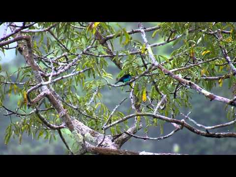
- On the banks of the Tiputini River you can see large land mammals such as tapirs, guantas and jaguars. Large aquatic and terrestrial reptiles such as caimans, anacondas, boas constrictor and charapas are frequently spotted. You can also observe aquatic and terrestrial mammals such as dolphins, otters, capybaras and felines swimming.
Tiputini River Attractions
-
- Beaches: Along the Tiputini River, some beaches appear only during the dry season when the river is low, but they are always small, never exceeding 100 m between the forest and the river.
- Yasuní Research Station (PUCE): Located inside the park, on the banks of the Tiputini River, is the Research Station of the Pontifical Catholic University, exclusively dedicated to research since 1993. With the capacity to house 50 scholars, its main activity is the knowledge of the local flora through various botanical studies.
- Biodiversity Station Tiputini (USFQ): Belongs to the University San Francisco de Quito and is located outside the boundaries of the Park, on the north bank of the Tiputini River, since 1994. It has a very complete infrastructure that includes research rooms, laboratories, herbarium, houses for students and an observation tower.
Transportation and access
-
- From the city of Coca -via Auca
- 54 km to Dayuma Parish
Communities
-
- Shuar
- Waorani
- Kichwa
Publicado en:
Publicado por: