Antisana - Volcano


Antisana
The Antisana is the fourth highest mountain in Ecuador and is also known as one of the most difficult to climb due to its glaciers and changing crevices that do not allow to define a standard climbing route.
-
- Elevation: 5,758 m (18,891 ft)
- Last Eruption: 1801
- First Climbers: Edward Wnymper & Carrel Brothers
- Best months to climb: Scalable year-round: however. The best months to climb are from November to February. The rainiest months are April and May.
It is located in the eastern mountain range of the Andes, 93 km (56 miles) 0 2 hours by car from Quito, taking the Viva Route, then the E35 to Pintag, from here the road to the Ecological Reserve has good conditions.
From the guard of the Antisana Ecological Reserve there are several routes of different difficulty levels that go along La Mica lagoon and are suitable for hikers and nature lovers. These routes offer an excellent view of the lagoon, the mountains around and on clear days a spectacular view of the Antisana. The weather changes very quickly, so waterproof clothing is recommended.
Meaning Antisana means lamb or dark mountain. Translated from Cañari language.
What does it take to get to Antisana?
To reach Antisana volcano top, technical and climbing equipment is required. It is recommended for experienced mountaineers. To make summit 51 a 4X4 vehicle is needed to reach the base of the mountain, also two special permits are needed
Ministry of Environment (+593 2) 398 7600
EPMAPS Company (+593 2) 299 4400.
Permitted Activities in the Antisana
-
- Trekking
- Mountaineering
- Camping
- Local fauna
- Birdlife
Note: There is no shelter on this mountain, however camping is allowed.
It is an active volcano that has grown on a previous cauldron. It is estimated that it has an approximate age of 800,000 years. It is known that it has not erupted but lava flow found in its environment is due to cracks of the volcano.
Mountaineering Antisana Volcano
Antisana, Ecuador.- It is a stratum volcano formed on the remains of a previous caldera with a diameter of 1,800 m that opened towards the east, recent lava flows can be found both on the flanks of the volcano and in the vicinity.
Antisana Volcano Location
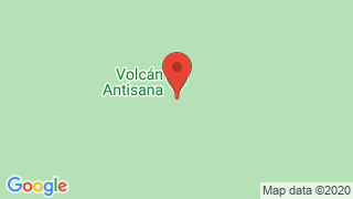
The Antisana-Volcan is located in the limits of the province of Pichincha and Napo, in the Real mountain range at a distance of 50 km southeast of Quito and 30 km west of Baeza. This huge massif is 5,758 meters high and 14 kilometers long.
Antisana Volcano Weather
The climate is humid, the average high temperature is 15 ° C very pleasant temperate climate and very low temperatures below 0 ° C. There are two types of differentiated seasons, Winter: That goes from November-February and Summer: That goes from March-October
Antisana Volcano How to get there
From Quito
To Mica. Take the Quito - Sangolquí - Píntag route. From the central park of Píntag, continue along the road to the Antisana volcano (suitable for all types of vehicles) until you reach La Mica checkpoint which is 35 kilometers and 45 minutes away (from Píntag).
Al Tambo From the Quito - Papallacta road (73 km) you reach the Valle del Tambo community, 5 kilometers before Papallacta, from where it connects with the well-known “Ruta del Cóndor” and the reserve control booth.
Antisana Tourism Volcano
-
- Lava flow of Antisanilla: Antisanilla is a lava flow that emerged from the earth - not from the crater of Antisana, as you might think - and that when it dried it left its obvious mark on the ground in the form of curious waves of stone that are worthwhile wonder.
- At its side, by the damming of the Isco River, which this same lava flow caused, the green-dark lagoons of Secas were formed, famous for their aptitude for fishing.
- Muerte Pungu Lagoon: It is occupying the bottom of the elevation boiler that bears the same name, whose highest peak is called The Preacher. Like most lagoons in the area, it is very suitable for fishing. Its access, floatable, is given by the sector of the Santa Rosa neighborhood, near Pintag.
- Santa Lucía or Mauca Machay Lagoon: It is also a favorite place for fishing and camping because its surroundings offer a beautiful landscape typical of height. It can be reached by a detour from the main access road.
Eruption of the Antisana Volcano
-
- The Antisana volcano has presented non-explosive eruptions in historical times, at most scattered clouds of ash and water vapor, however, the main feature of this volcano is its thick lavas that have traveled tens of kilometers even in recent years and that have arisen from fissure eruptions not coming from the crater. This case of eruption is unique in the volcanoes of Ecuador.
- The Antisana has had several historical eruptions. In 1728 the Antisanilla lava flow was formed whose emission point is located 12 km southeast of Pintag while in 1773 the Potrerillos lava flow that reached the Papallacta river was emitted. Humboldt also spoke of activity in the Antisana in 1801.

Publicado en:
Publicado por:


